
 phys.org/news/2026-10-advance-aquifer-remote-statistical-groundwater.html
Researchers advance aquifer mapping using remote sensing and statistical models to improve groundwater management
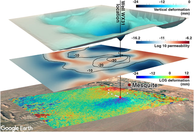
Satellite measurements of how much the ground sinks during pumping were enough to map permeability across a municipal aquifer in Nevada, using free, public InSAR data. The maps revealed a high-permeability channel on the aquifer's southern end and a low-permeability zone that earlier research had suggested might be a fault.
— via Phys.org
